National Museum of Singapore: What to See
Discover what to see at the National Museum of Singapore, including Singapore Odyssea, exhibitions, history, architecture and visitor information.
Henderson Waves is the iconic walkway of the Southern Ridges, a route linking several green spaces in southern Singapore. This pedestrian bridge crosses Henderson Road between Mount Faber Park and Telok Blangah Hill Park. It allows you to walk above the road, at canopy level, with openings onto the surrounding neighbourhoods and harbour landscapes.
The appeal of this elevated walk is not limited to the bridge: the hills, wooded paths and gardens create different routes depending on your chosen starting point. A visit focused on contemporary architecture requires different preparation from a longer hike towards HortPark or Kent Ridge. The terrain, humid heat and condition of the access routes matter more than the simple distance shown on a map.
To discover the area without turning your outing into a challenge, decide first where you will arrive and leave, then adapt the walk to the weather. Check access conditions and any closures with NParks before setting off: an open structure does not guarantee that all the surrounding connections are open too.
In brief
Henderson Waves’ undulating shape is its signature feature. Its framework creates successive curves around the walkway, while the wood gives the visible surfaces a warm tone. Some alcoves allow you to stop without standing in the middle of the path.
The structure is interesting both for its function and its appearance. It provides a pedestrian connection between hills separated by a road, while turning the crossing into an observation point.
Look at the bridge along its length rather than only from the side: the repetition of the curves changes as you walk. Open sections and side enclosures alternate, creating different views of the trees and buildings.
The contrast with the vegetation explains much of the site’s photographic appeal. Here, contemporary architecture does not replace the landscape: it provides a path from which to see it differently, above the traffic.
When photographing the structure, wait until space is available and position yourself without blocking other walkers. The alcoves are useful for studying the details; the lengthwise perspectives show the succession of waves more clearly.
The urban panorama appears between the trees and varies according to your position. Do not expect an unobstructed view in every direction: the foliage is part of the experience and hides some horizons.
The bridge is also a busy thoroughfare, not a viewpoint reserved for contemplation. To extend your discovery of Singapore’s landscapes, our selection of green spaces and nature outings lets you compare the atmosphere of different parks.
The best view of the bridge is built up as you walk: its curves, openings and surroundings are easier to understand by crossing it than from a single spot.
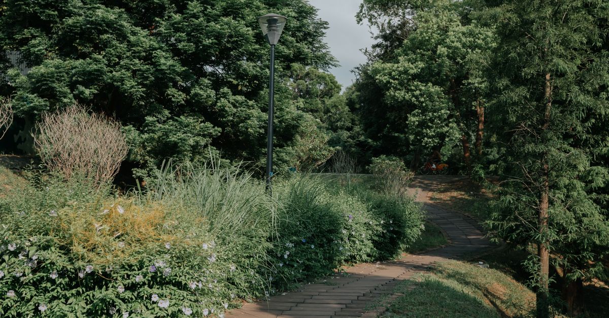
Start by choosing the places you want to connect. The Southern Ridges combine park paths, pedestrian structures and wooded areas. The phrase “elevated walk” therefore does not mean that the entire outing takes place on a bridge.
Mount Faber, Telok Blangah Hill, HortPark and Kent Ridge are different stages of the route. Adding Labrador changes the logic of the journey again, directing it towards the coast rather than only along the ridges.
To prioritise the bridge, limit your programme to crossing it and visiting the nearby parks. This leaves time for viewpoints and breaks, without requiring a long continuation when the heat becomes oppressive.
A return trip simplifies getting back to a familiar transport point, but means tackling the same terrain again. A through-route avoids this repetition, provided you have identified an exit that is genuinely accessible at the other end.
| Proposed route | Main interest | Point to check |
|---|---|---|
| Mount Faber and Henderson Waves | Combining viewpoints with discovering the bridge | Climb from the arrival point |
| Henderson Waves and Telok Blangah Hill | Continuing the crossing through a leafy park | Exit route and stairs |
| Continuation towards HortPark | Moving from wooded hills to landscaped gardens | Whether intermediate connections are open |
| Extension towards Kent Ridge or Labrador | Discovering another landscape and its historical context | Exact route and return transport |
If you continue towards HortPark, the landscape changes: the focus shifts more towards plantings and horticultural features. Kent Ridge adds a historical dimension linked to Singapore’s defence during the Second World War, which you can discover through the interpretation provided on site.
Do not build your day around a connection that you assume will be open. Check NParks notices concerning Forest Walk and nearby passages, then keep an intermediate exit in mind. The right route is one you can shorten without improvising a descent.
HarbourFront is a convenient starting point for reaching Mount Faber on foot. This option suits you if the climb is part of your plan. However, travelling to the area by MRT does not mean arriving directly at bridge level.
Access points near Henderson Road offer another approach, depending on the direction of your walk. Check stops and routes with the Land Transport Authority or the relevant operator, as services may change.
A taxi can bring you closer to a park entrance, but the destination must be an authorised drop-off point accessible to vehicles. Simply saying “Henderson Waves” does not necessarily identify the correct pedestrian access.
The Mount Faber cable car can form part of a panoramic outing, but it does not drop you at the bridge. If you choose this option, check the operating hours, operating conditions and fares with Mount Faber Leisure Group.
Our guide to transport in Singapore helps you combine the MRT, buses and the final walk. The aim is to avoid putting all the physical effort into the climb before you even reach the crossing.
A level surface on the bridge does not guarantee an obstacle-free route. The approaches may include slopes or stairs, which matters if you are using a pushchair or wheelchair, or have difficulty walking.
Ask NParks which route is suitable for your needs and check the exit route as well. A comfortable arrival is not enough if the return involves an unsuitable descent.
Finally, identify toilets and refreshment options in the parks you visit, without assuming that they are located along every section. Planning your return from the outset keeps the walk flexible.
The tropical climate affects the effort more than the well-maintained appearance of the paths. A walk on an even surface can become tiring when humidity reduces comfort and climbs follow one another.
The morning allows you to start a longer outing before the strongest heat. In the late afternoon, the light often becomes more attractive for viewing the landscape, although sunset can also draw more visitors.
Take water with you from the start and drink regularly, rather than waiting to find a shop. Lightweight, breathable clothing, sun protection and shoes that hold your feet securely meet the usual needs of this walk.
After a shower, wet surfaces, leaves on the ground and steps require extra attention. A grippy sole is more useful than bulky hiking equipment for a visit focused on maintained paths.
If you hear thunder, leave exposed areas and seek a suitable building or shelter. The vegetation and curves of the bridge do not provide protection from lightning. Check the forecasts and alerts from the Meteorological Service Singapore before setting off.
The lighting of the structure should not be confused with continuous lighting along the surrounding paths. Check the applicable access and illumination hours with NParks, then choose an exit that you will be able to reach after dark.
A downloaded map and a sufficiently charged battery make navigation easier. To better understand showers and plan outdoor activities, see our page on Singapore’s climate and seasons.
Shortening the outing when the weather worsens is preferable to continuing a route planned on a screen.
The Southern Ridges let you observe vegetation at different heights. From the elevated paths, your gaze reaches the branches and treetops; at ground level, your attention shifts to the undergrowth, roots and plantings.
This alternation offers an interesting reading of the landscape, without making every section an untouched tropical forest. Maintained gardens, edges and wooded areas also reflect how green spaces are planned in a dense city.
Move calmly and stop to the side when movement in the trees catches your attention. Seeing birds or other animals depends on the conditions at the time: it is better to welcome an encounter than to chase it.
Do not feed the wildlife and keep your food stored away. For a break, use a designated area, then take your wrappers and food waste with you.
Sounds are also part of the experience. Keeping conversations at a moderate volume and avoiding playing music allows you to hear the birds while respecting other walkers.
After walking towards HarbourFront, having a meal in the area limits additional travel. If your walk ends near HortPark or Kent Ridge, choose an address that works with your return transport instead.
Our guide to Singapore restaurants and cuisine can help you plan this break. To round off the day without adding unnecessary journeys, also compare the things to do in Singapore by neighbourhood.
Your exit point should guide the rest of your programme, rather than choosing an address that forces you to cross the city again after the walk.
Yes. You can focus your visit on the bridge and nearby parks. Choose your access point with slopes, stairs and return transport in mind.
A short walk may suit children if you include breaks and bring water. If you are using a pushchair, check the full route with NParks: some access points include stairs or slopes.
Check the illumination hours and access conditions with NParks before your visit. Also plan your exit, as lighting on the bridge does not guarantee lighting on the surrounding paths.
Respect the barriers and follow NParks’ instructions. Limit the walk to an accessible park or use an authorised exit, without attempting to bypass the closure via an unmarked path.
Updated on 02/11/2026
Scroll to see more articles →